Flood Monitoring for Agriculture
Protect farm buildings, grain stores, and livestock housing with real-time flood intelligence — so you can act before water reaches your land.
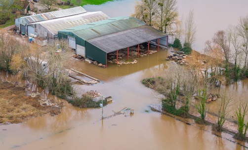
Why Agricultural Operations Need FloodWatch
Farms face unique flood risks — from flash flooding in low-lying fields to river overflow threatening livestock and stored crops. Here's how agricultural operations currently manage flood risk.
Checking weather forecasts and hoping for the best — no visibility of river levels near farm buildings
Real-time river level monitoring at nearby gauging stations with 24-hour trend data and rising/falling indicators
No advance warning before flooding reaches grain stores, livestock housing, or machinery sheds
Proactive email alerts when flood severity changes at any of your monitored sites
Managing flood risk across multiple farm sites, tenanted land, and dispersed buildings with no central view
All farm sites visible on one dashboard with automatic severity prioritisation and risk scoring
Struggling to document flood events for insurance claims and grant applications
Export PDF summaries and CSV data with audit trails for insurance evidence and regulatory submissions
Purpose-Built for Agricultural Flood Resilience
FloodWatch gives farming operations the flood intelligence needed to protect buildings, infrastructure, and livestock.
Map Every Farm Site
Name and locate every building — barns, grain stores, livestock housing, machinery sheds — with address geocoding, coordinates, and building polygon verification.
Severity at a Glance
Instantly see which farm sites face the highest flood risk. Colour-coded severity levels and 0-100 risk scores help you prioritise where to act first.
River Level Tracking
Monitor water levels at gauging stations near your farm sites with 24-hour trend data. Know whether rivers are rising or falling before water reaches your land.
All-UK Coverage
Unified view of flood data from Environment Agency (England), Natural Resources Wales, and SEPA (Scotland). Full coverage for farms across Great Britain.
AI Situation Briefs
Generate concise flood situation reports during active events. Share with farm managers, landowners, insurers, and emergency responders.
Insurance & Compliance Exports
Export PDF executive summaries and CSV data with audit trails — suitable for insurance claims, grant applications, and regulatory evidence.
Proactive Email Alerts
Automatic notifications when flood severity changes at any of your sites. Configure thresholds to match your operational response plan.
Team Access & Roles
Give farm managers, estate teams, and landowners the right level of access. Role-based permissions keep everyone informed.
Coming Soon
We're building these capabilities based on customer demand. Register your interest and help shape what we build next.
Pluvial & Flash Flood Coverage
Surface water and rapid onset flooding, not just river — critical for low-lying farmland and areas with poor drainage.
Soil Moisture & Infiltration Rates
Integration with soil monitoring data to predict waterlogging and runoff risk before flooding occurs.
Field Mapping
Map individual fields, track drainage infrastructure, and identify low-lying areas most vulnerable to flooding.
Water Level Tracking at Farm Buildings
Monitor potential water levels at key structures — barns, grain stores, livestock housing — with building-level flood depth estimates.
Weather-to-Field Risk Correlation
Link rainfall forecasts directly to field-level flood risk, giving you advance warning tailored to your specific land and terrain.
Simple, Transparent Pricing
Plans for every portfolio size. No per-site fees, no hidden costs. Features marked Professional require a Professional plan or higher.
Interested in upcoming features?
Join the waitlist for founding member pricing and priority access when these features launch.
Join the Professional WaitlistGet started with FloodWatch
Tell us about your portfolio and we’ll be in touch within 1 business day.